This page covers maps produced of the world of Rathnir. To read about the world itself, see Rathnir .
PLEASE ADD ANY MAP YOU MAKE TO THE MOST FITTING SECTION, or feel free to make new sections if required.
This page is dedicated to uploading maps that depict Rathnir. Every map uploaded here should have a caption of its contents and the date it depicts.
Link to Rathnir's Dynamic Map: http://45.58.126.209:2096/
Latest Official Rathnir World Map [ ] This is the link to Juno4321's ImgBB page where new and updated maps are regularly posted: https://juno4321.imgbb.com/ (Juno's maps can no longer be posted here due to file size, so make sure to check out their page for their map updates!)
NebularSpace's World Map Updates can be seen here: https://nebularspace.imgbb.com/
Map as of 3 March 2024:
Expanded Maps of Rathnir (to include off-map locations) [ ]
Blank map of Rathnir and part of the Far West region, as mapped on 20/11/21
Rathnir's Far West region with annotated names, as mapped by JurassicParkRex on 22/11/21.
Blank map of Rathnir and part of the Far West, as updated on 25/12/21
The full map of the known world, as of May 2023.
Historical Political Maps [ ]
Rathnir upon the end of the server, 30th March 2024
Viomelian Projection of Rathnir countries roughly on 20 November
Political world map roughly on 30 November
Political world map on 6 December 2020 (made by Emperor_Scoubs)
World map on 9 December 2020
Map of alliances on 9 December 2020 (made by the great Viomelia)
Map of Rathnir from the Atlas of Athaz. December 9th, downscaled, exonym edition
Alliances of Rathnir--WhiskeyKnight
Map of Rathnir on 20 December
Soleannen Empire and its protectorates at the end of the Dandelion Wars (bars are contested territory))
Bardonian Empire and its protectorates at the end of the Dandelion War (lined areas are contested territory)
Guild of Mapmaker's edition 25 February 2021
Guild's map on 3 March 2021
Guild's map on 10 April 2021
Provinces of the Aurlûnor Velande
Guild's map on 25 March 2021
Culture Maps [ ]
Escharian Cultures of Escharia
The Modern Niedene Race by Sieg
Ethnicities of the Aurlûnor Velande
Regional Political Maps [ ]
Sparwood with UBSR and allies labeled
Countries of the Silver Coalition
Coltmaere provincial/city map
The Dominion of Ashura before it's collapse.
Continent of Alteniquia, Atlas of Athaz, December 10th
Bardonia Region Map, 15th December 2020
Carvaian Internal Territories (1/1/2021)
Regional Map of Palaris, 17th December 2020
Regional map of Osudal's location names before its collapse- January 20th
Regional Map of Ryzan, 5th March 2021
Order Müvielle's Regional Map, May 5th 2021, prior to it uniting with Floramia
Regional map of the Simulami Empire's mainland on Rathnir as of August 16th 2021 by Bij0n_
Tovarisha Region map as of 11/16/21
Map of the Federation of South Vastallos 22/12/2021
Map of the Arcadian Realm of Astana 25/12/2021
Hearthstone Yuldai as of 19/05/2022
Political Map of Alda late April 2022
Map of Ummarnu by Orleborle
Political map of the High Kingdom of Daelyria
Valoore Political Map during Michael's rule
BSS Maps [ ]
Height of the First Ardatian Empire but better - 2,100 BSS
Domains of the Niedene peoples around ASC: 1300 by Sieg.
Map of Southern Syltör by the time of the arrival of the Elves, 15,000 BSS
The height of the Empire of Almador with early Ashura pictured in 3,500 BSS
Old Kingdoms of Talawa-4,500 BSS by WhiskeyKnight
Height of the First Ardatian Empire-2,100 BSS by WhiskeyKnight
Ashurite Tribes-3,500 BSS by Coffee
City and Satellite Maps [ ]
Map of Erðvald, Capital of Frostmarch
Map of Tossagrad, Capital of Ryzan, 24th February 2021
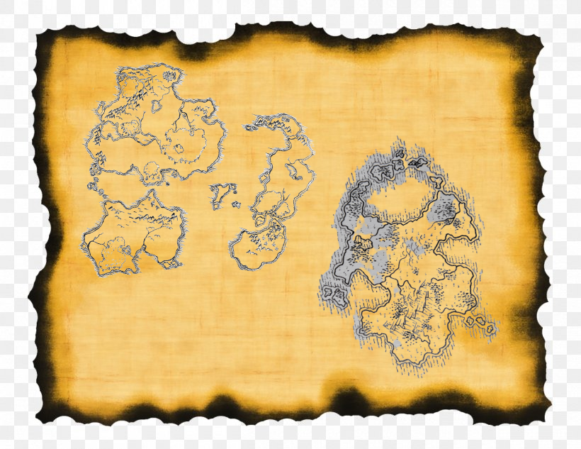
Blank Maps of Rathnir [ ]
Athaz's base map of Rathnir c. October 2020.
NebularSpace's Rathnir base map.
A map of Rathnir from an aerial perspective from March 2022.
Hazelnut's Rathnir base map, c. May 2022.
Alamu's Rathnir base map.
Rex's Wikipedia-style base map.
Alamu's continent map, c. 2022.
A blank map of the known world, c. April 2023.
Another known world base map, by Rex.
Nation Maps [ ]
The Sinatra Mafia right before its collapse
Huitca right before it's collapse
Solisios right before it merged with Ardat Mosul
Race Maps [ ] Original map of the Lost Isles of Mardelska (fully inhabited by Slimerion race. )
Fictional Maps [ ] '
alternative/theoretic map of how rathnir may look like before it is freezed, by TheFutureCraft.
'
")
")
")
")
")
")
")
")
")
")
")
")
")
")
")
")
")
")
")
")
")
")
.png "Unknown (4).png (1.48 MB)")
")
.png "Unknown (5).png (1.47 MB)")
")
")
")
.png "Unknown (1).png (800 KB)")
")
")
")
")
")
")
")
")
")
")
")
")
")
")
.png "Something something (1).png (2.31 MB)")
")
")
")
")
")
")
")
")
.png "Screenshot (303).png (1.55 MB)")
")
")
")
")
")
")
")
")
")
")
")
")
")
")
")
")
")
")
")
")


